-
 Golden light illuminates Fox Glacier / Te Moeka o Tuawe as the sun sets over the Tasman Sea
 -
 Recent rain at Lake Hauroko, New Zealand's deepest lake, results in the lake being that little bit deeper
 -
 For a brief minute or two the wind stops, the lake goes still, and Aoraki-Mt Cook reflects perfectly in Lake Pukaki
 -
 A fresh winter coat of snow drapes the mountains surrounding Lake Heron, Canterbury
 -
 Nor'wester storms can quickly transform Canterbury's alpine lakes, including Lake Pukaki, from placid calmness to raging surf
 -
 Fiordland National Park is home to thousands of rivers and streams which flow through primordial forest
 -
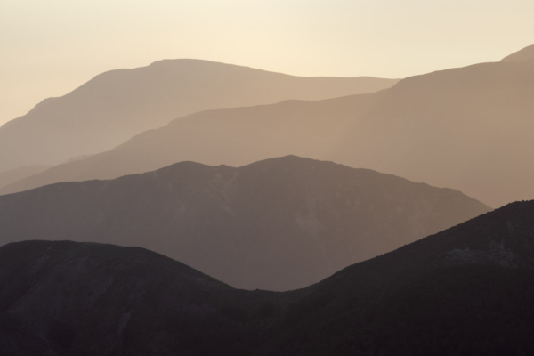 The foothill ranges between Mt Hutt and Mt Somers provide this great layering effect
 -
 The seemingly never-ending ranges of Kahurangi National Park, viewed from a peak 1,805m high in Nelson Lakes National Park
 -
 The seemingly never-ending ranges of Kahurangi National Park, viewed from a peak 1,805m high in Nelson Lakes National Park


