Location: Canterbury
Kaikoura, Canterbury Plains, Aoraki-Mt Cook National Park, Mackenzie Basin
-
 When the hoar frost descends on the Mackenzie Country it can be so intense that it looks like snow!
 -
 Although mostly purples and pinks, lupins can be found in a diverse range of colours (Lake Tekapo)
 -
 An aerial view of the Godley River has it descends from the Southern Alps towards Lake Tekapo
 -
 Although predominantly seen in purples and pinks, lupins can be found in nearly every colour of the rainbow.
 -
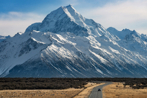 New Zealand's highest mountain, Aoraki / Mt Cook (3,724m), looms large over State Highway 80.
 -
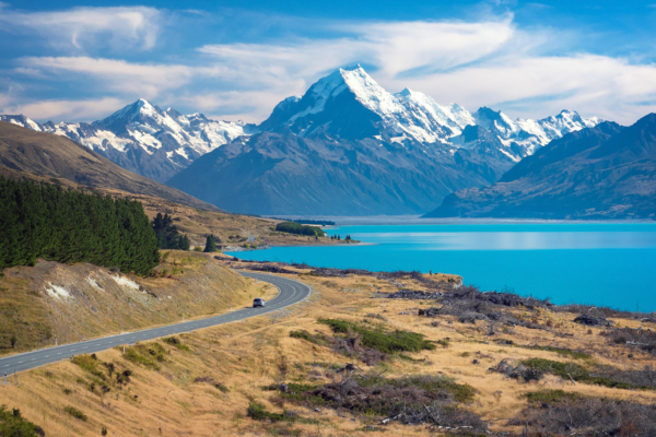
 When you're on State Highway 80 and have this view of Lake Pukaki and Aoraki - Mt Cook, you know only good things lie ahead.
 -
 The glowing summit of Mt Sefton (3151m), captured approximately 30 minutes before sunrise
 -
 A spectacular sunrise on a windy morning in the Tasman Valley heralds bad weather ahead