A Brief Guide to the South Island
Looking for a brief guide to the South Island for landscape photographers? Well this A Brief Guide to the South Island for Landscape Photographers might almost be just what you’re looking for!
I often get messaged by photographers planning their first trip to the South Island and wanting to know the best time to visit, how long they should stay, and where the best spots to photograph are. This guide is an attempt to pull together that info in one place. It’s by no means exhaustive but should hopefully provide a useful start to planning that epic photography trip!
Getting about
Overall, travelling around the South Island is pretty easy. Christchurch International Airport is usually the main entry point for visitors, although Queenstown and Dunedin are also useful options depending on where you want to start.
Wherever you land, I recommend travelling under your own steam, be it a rental car or campervan. For a landscape photographer, this provides the greatest flexibility to be in the right place at the right time, something which the available public transport options here simply don’t provide. Most of the usual suspects in the rental car market (Avis, Budget, et al.) have outlets across the island.
Unless you’re going well off the beaten track a 2WD will be sufficient, although a 4WD might be a better option in winter (along with a set of snow chains – most major routes in the South Island involve an alpine pass at some point).
The main roads are sealed and well maintained, although might be a little narrower and curvier than you’re used to. Travel times can be longer than expected due to said curves (not to mention also due to the erratic driving of tourists taking in all the scenery). In NZ we drive on the left and the open speed limit is 100 km/h.
Check out my A Brief Guide to South Island Roads for more info and images.
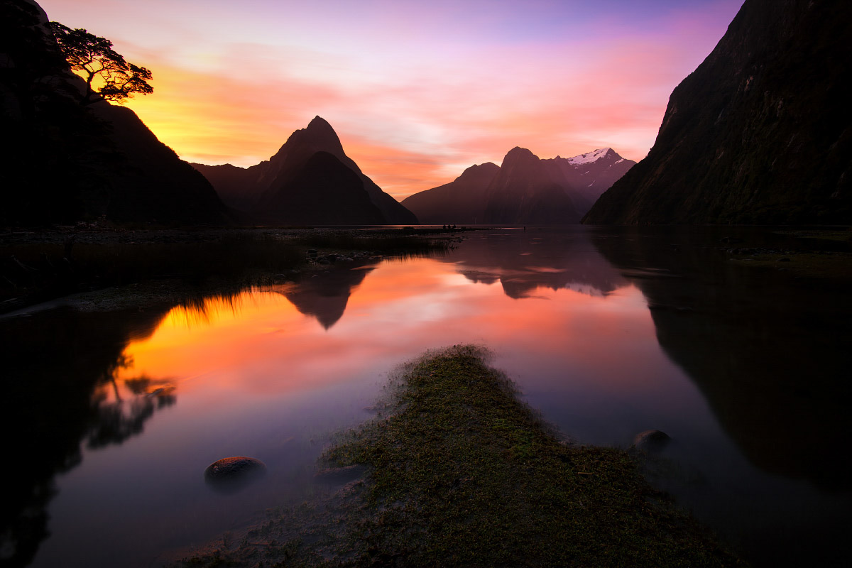
Milford Sound, Fiordland National Park

Lake Kirkpatrick (near Queenstown) with a coat of winter ice

The jetty at the Marakura Yacht Club, Lake Te Anau
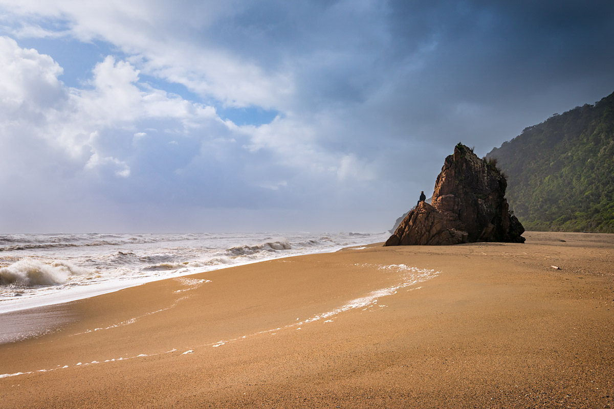
Scott’s Beach, near the start of the Heaphy Track

A wintery hoar frost scene near Twizel, Canterbury

Lake Wanaka under a nor’westerly sunrise
Places to stay
If you’re travelling by road then accommodation is never too far away. That said, in national parks (such as Fiordland and much of the West Coast) places to stay are more sparse, so before venturing through these areas be sure to know where you’ll be staying that night. For those on a budget we also have plenty of holiday park and campgrounds, including a great network run by the Department of Conservation. Freedom camping is permitted in a lot of places but in some areas is strictly forbidden. Be sure to tidy up at yourselves as we NZ’ers rightly get very grumpy at people spoiling our countryside.
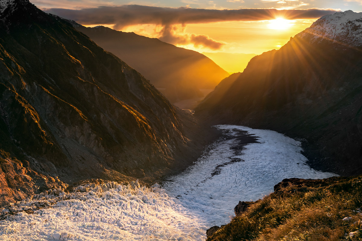
Fox Glacier descending towards the West Coast

13 Mile Beach, located north of Greymouth and accessible only at low tide
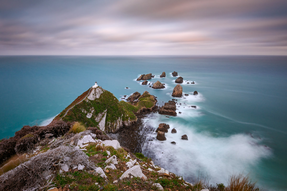
Nugget Point on Otago’s rugged coastline

The lupins in the Tekapo area begin flowering in early November.
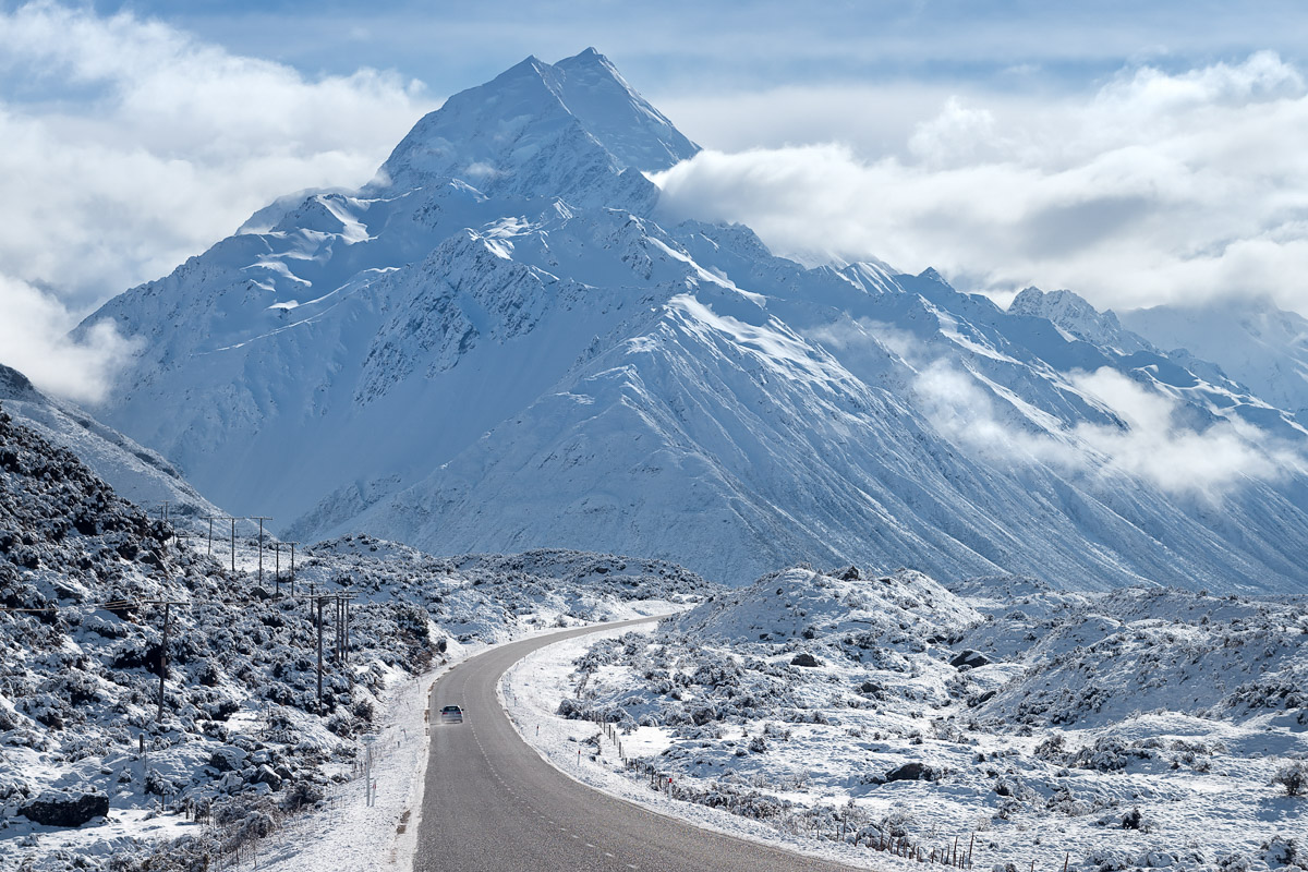
State Highway 80 and Aoraki-Mt Cook in mid-winter

Moria Gate Arch, Kahurangi National Park
Weather
It’s impossible to summarise NZ’s weather in a way that’ll meet the ‘brief’ terms of this guide. Perhaps ‘highly variable’ would best cover it?
To explain just a little, the South Island is a long, skinny, and mountainous landmass surrounded by ocean, with said landmass providing a ginormous barrier to the prevailing westerly winds. As such, even though it’s a small island the weather can be completely different at locations just 50 km apart. The conditions can also change quickly, hence we NZ’ers often refer to experiencing four seasons in one day. Certainly our weather often catches out people from continental climates who are used to more predictable and stable weather.
Much of the South Island receives somewhere between 400 and 1600 mm rainfall annually, generally spread throughout the year. The western side of the island gets more rain than the east, but that usually comes in concentrated bursts (meaning long fine spells are a regular feature). Deep in the mountains of the West Coast (which can’t be accessed via vehicle), rainfall is measured in metres rather than millimetres. The Cropp River gauge holds a 365 day record of 18.4m!
July is usually the coldest month and January or February are usually the warmest. Using Christchurch as a reference point, the average January daily maximum and minimum is 23 and 12 degrees Celsius respectively, with July bringing 11 and 2 degrees respectively. Snow can fall in mountainous areas at any time of the year, and on occasion drops to sea level throughout the lower island during winter. Temperature falls around 1.0°C for every 150 m increase in altitude. And it doesn’t matter where you are; wind is a fairly regular feature!
Most of the South Island receives at least 2000 hours of sunshine annually. Due to our low air pollution levels, UV radiation from the sun can be harsh, so good sun protection is a must.
The best advice is no matter what time of year you visit, bring sufficient gear to cope with both summer and winter conditions.
Our national weather forecaster is MetService. Detailed forecasts are available for towns and cities, rural areas, and national parks.

Lake Pukaki can often resemble the sea when the nor’west wind is blowing

The great coastal road between Greymouth and Westport
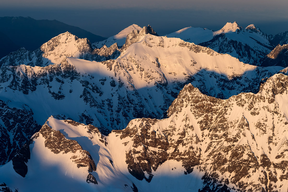
The mighty Southern Alps at sunrise
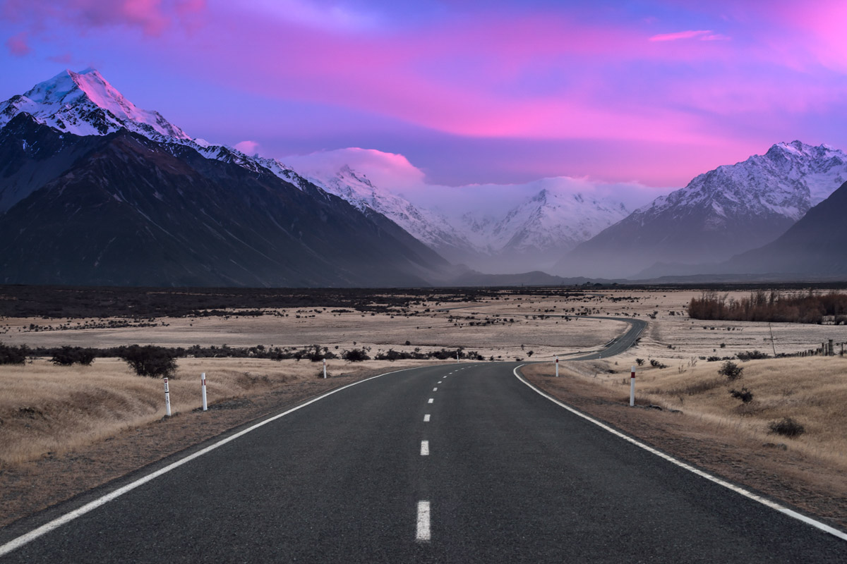
State Highway 80 approaching Aoraki-Mt Cook National Park

Perfect reflections on Lake Wakatipu as seen from Bennetts Bluff

The foothills of the Southern Alps viewed from Mt Hutt ski area
Photography through the Seasons
In my opinion there’s no such a thing as a bad (or conversely, perfect) time to visit. At any time you’re very likely to come away with spectacular images. Below are some observations and tips relating to the specific seasons.
At NZ’s latitude the summer daylight hours are fairly long, which means not much sleep for photographers looking to take advantage of the golden hours. For example, on the longest day in Christchurch (December 21st) the sun will rise at 5:44 and set at 21:10, with a good hour of usable light on either side. Further south there’s around 18 hours of usable light at the summer solstice.
A photography option unique to summer is the colourful lupins, which start flowering in early November and usually peak at the beginning of December. These can be found in a few places throughout the middle of the island (sometimes in places they shouldn’t be – they’re a weed species), but are most famous around the Tekapo area. Check out my A Brief Guide to Lupins for more info.
The snow line is drifting upwards rapidly, making access into the mountains much easier if you’re looking to tramp (hike). The Aoraki – Mt Cook area has some amazing day walks set among our highest peaks, such as the Hooker Valley track and Sealy Tarns. My A Brief Guide to Aoraki/Mt Cook National Park has lots more details!
Beaches are of course popular if you like to mix your photography with other leisure. The top of the South in the Nelson, Abel Tasman National Park, and Golden Bay regions has endless beaches of golden sand set against sparkling turquoise water.
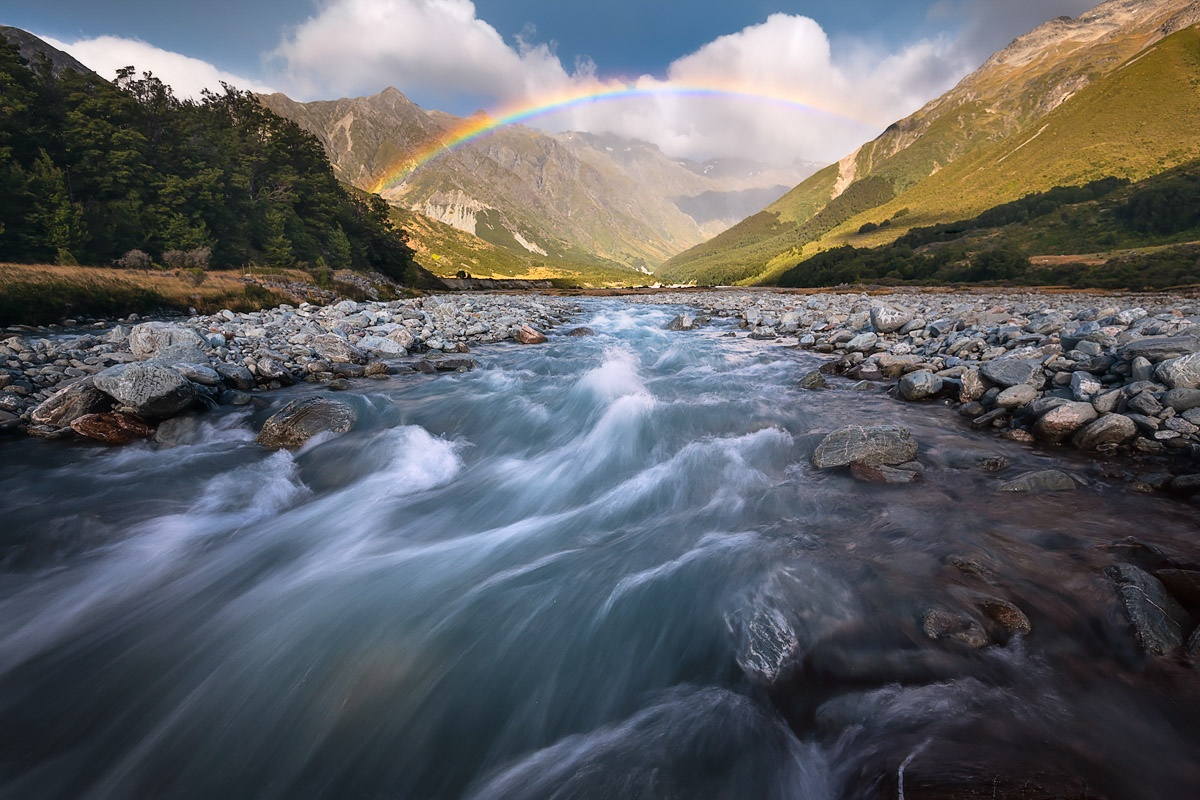
The temperature starts dropping noticeably throughout March, which coupled with shortening daylight hours and the first dusting of snow on the alps, certainly gives the clear impression that winter is on its way. That said, the weather is usually fairly pleasant and there’s often long stretches of settled weather (a great time for water reflections – see my A Brief Guide), interspersed with the occasional storm front from the west or south. It’s a tough call, but autumn is probably my favourite time of year for both adventures and photography.
Central Otago is amazing in autumn, with golden leaves set against blue skies and mirror lakes. Wanaka, Queenstown and Arrowtown all have endless options for that sort of photography.
With long settled patches of weather it’s usually a perfect time to visit the West Coast and Fiordland areas, where cool misty mornings give way to blue sky days, with hopefully just the right amount of cloud returning for sunset. I’ve written two articles covering some primo spots in these areas: check out A Brief Guide to Milford and Doubtful Sounds and A Brief Guide to Karamea for more info.
Daylight hours are at their shortest, so if you enjoy your sleep like me, life as a photographer becomes a lot easier! Again using our reference point of Christchurch, at the winter solstice (21st June) the sun will be rising at 8:00 and setting at 17:00.
Snow and frost arrives in the high country, so regions such as the Mackenzie Country and Nelson Lakes give plenty of opportunities to get some of the cold white stuff into your shots. When it gets super cold, a weather phenomenon known as the ‘hoar frost’ can trap the Twizel and Alexandra landscapes in a layer of ice, making for an incredible winter wonderland. Take a look at my A Brief Guide to Lake Tekapo to see more from this area.
The Milky Way core is high in the sky, so if you’re into your astro photography now’s a great time to visit. If you’re lucky, in the southern half of the island the Southern Lights (Aurora Australis) may make an appearance.
NZ’s indigenous forests are evergreen, so luxuriant forest interior shots are possible even in the depths of winter.
Much like autumn, I enjoy Spring for it’s not-too-early and not-too-late golden hours, as well as the increased likelihood of atmospheric haze and mist to bring depth to images.
Spring means blossom, daffodils, lambs and other assorted photography cliches, all of which are available in abundance throughout much of the developed areas of the South Island in the early part of the season. Christchurch and hinterland is a great one-stop-shop for all such things.
Coastal areas like the Catlins, Kaikoura, Akaroa and Marlborough Sounds are absolutely beautiful in Spring – misty mornings, sunshiney days, and crisp evenings.
Although the temperature is gradually warming the mountains will still be holding a lot of snow. While making for great photography, the risk of avalanches in the high country is much increased. Because of this some of the sub-alpine and alpine tracks, which have been closed over winter, can remain closed for much of early Spring.

Endless mountain ranges across Kahurangi National Park
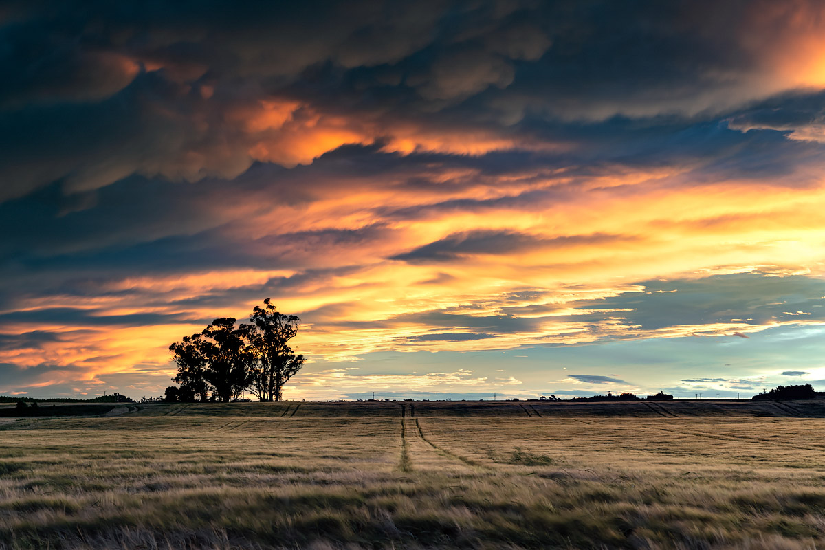
A classic Canterbury sunset
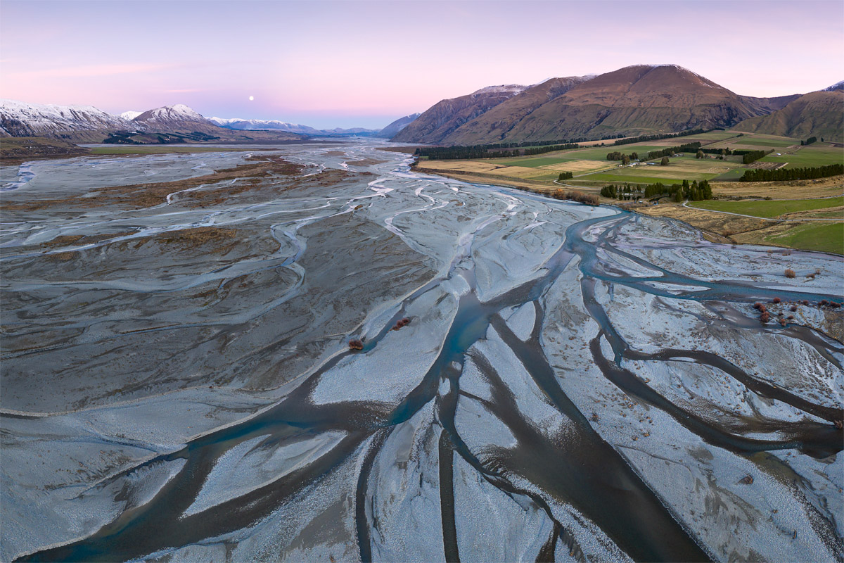
One of the South Island’s many braided rivers, the Rakaia

Archway Islands, Wharariki Beach

Lake Matheson, Westland Tai Poutini National Park

If you’re lucky you may catch the Aurora Australis (Southern Lights)
Trip length
This is something I get asked about regularly and it’s a very difficult one to answer. Ultimately it’s something only you can decide and comes down to your budget and time available. The only suggestion I can make is to stay as long as you can! Noting that I’ve lived in the South Island for nearly all my life and yet I’m probably only quarter-way through all the locations I want to photograph…
That all said, it’d be quite possible to fill your memory cards with a diverse range of South Island landscapes in 9-10 days. Although I stress this would be extremely tight and with the weather the way it is there’s likely to be a few occasions which aren’t ideal during that time. Again, the only way to reduce this risk is to stay longer.
An example itinerary
Here’s a 9-day trip based on flying in and out of Christchurch. There’s no doubt this 2,000 km epic crams a lot into a short space of time, but it does take in a heap of my favourite locations as well as showcasing the diversity of the South Island’s landscapes. As mentioned just above, there’s a real risk that sometime in those 9 days the weather could spoil one or more of these locations, so any extra days you can squeeze into your schedule would likely be a good idea.
Day 1 Christchurch – Tekapo (245 km, 3 hrs)
Day 2 Tekapo – Mt Cook (115 km, 1 hr 45 mins)
Day 3 Mt Cook – Wanaka (210 km, 2 hrs 30 mins)
Day 4 Wanaka – Queenstown (70 km, 1 hr 10 mins)
Day 5 Queenstown – Milford Sound (290 km, 4 hrs)
Day 6 Milford Sound – Queenstown (290 km, 4 hrs)
Day 7 Queenstown – Fox Glacier (330 km, 4 hrs 30 mins)
Day 8 Fox Glacier – Punakaiki (240 km, 3 hrs 15 mins)
Day 9 Punakaiki – Christchurch (290 km, 4 hrs)


A stormy evening at Lake Tekapo
A clearing storm in Aoraki-Mt Cook National Park

The kea, the world’s only alpine parrot (click image to read my A Brief Guide)

Lake Heron, Canterbury

An aerial view of the Godley River flowing into Lake Tekapo

McLeans Falls, one of the many waterfalls in The Catlins
Great guide Daniel!! I’m spending a few weeks in NZ later this month…spending most of my time on the South Island, for sure. Do you recommend a place or two for some great shots on the drive from Queenstown to Te Anau?
@eat_wander_repeat
Thanks Hannah! There’s a couple of spots along Lake Wakatipu which access the foreshore and are well worth a look. The wind farm near Mossburn might provide something a little different. And definitely take the diversion to Manapouri on the way, and once you’ve spent some time there, pull into the Rainbow Reach on the way through to Te Anau (can walk part of the Kepler Track through some stunning forest).
Fantastic information, when one ventures into any mountainous area, or costal area your advice on how to dress is excellent, layers one of the important key to survival, be prepared for all conditions. Pack your food and all that you may need to survive for several days. I have seen it snow on the forth of July, the mountains make there own weather, just as the coast can be warmer in the winter than in the summer depending on the prevailing winds. That is the beauty and wonder of this small planet we call home. Thank you Daniel, it is important to know what the potential conditions will be, so that a visit any where is most enjoyable.
Great comment! Unfortunately a of of people do underestimate the weather, which is especially the case in NZ where the conditions are so changeable. In our alpine areas it can go from sunny and warm to snow blizzard in under 30 minutes. As you say you need to be prepared for all conditions!
Wish I’d read this a week ago when I arrived!
Hope you’ve had a successful time of it anyway! 🙂