A Brief Guide to Lake Tekapo
Once a small town you passed through on the way to somewhere else, over the last few years Lake Tekapo, New Zealand, has become a major destination in its own right. Whether because of its inclusion in the world’s largest dark sky reserve, development of awesome visitor facilities such as the Tekapo Springs hot pools, or the vast natural beauty on its doorstep, the town has become incredibly popular in recent times.
On the accommodation front, there are several options ranging from a 5-star hotel all the way through to a holiday park. During the peak visitor season (typically November-March) these facilities tend to be very busy so it would pay to book well in advance. There’s a 4-Square supermarket, a petrol station, and a diverse range of eating options.
The summers are warm and the winters very cold. Rain doesn’t fall very often (an average of just 600 mm spread over 78 days per annum), and while snow is reasonably common in the winter months, it doesn’t usually settle in the town for more than a few days at a time. In my opinion there’s no such thing as the best or worst time to photograph the area; the whole year offers up plenty of perfect opportunities!

Lake shore
The town sits right on the southern edge of the lake, so for photographic treats there’s no need to walk far. The most common access points to the rocky shore are from the Church of the Good Shepherd (covered further below) or straight in front of the main retail area beside State Highway 8. Because the lake is controlled for hydro electricity generation its level does vary throughout the year, which makes for some variation in the rocky foreground.

A couple of minutes after this shot the heavens opened and I was running!

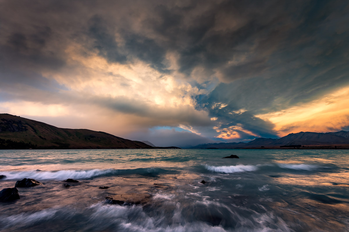
Quite possibly the most epic light and colour I’ve yet experienced; taken on a late December (summer) evening
Taken on the same evening as the previous shot, around 30 minutes prior
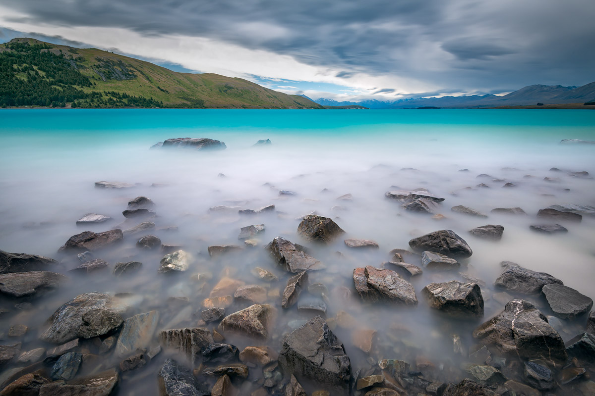
A long exposure of a stormy day has smoothed out the turbulent and silt-laden water

Finding an eye-pleasing arrangement of rocks can often be tricky; was stoked to come across this line-up
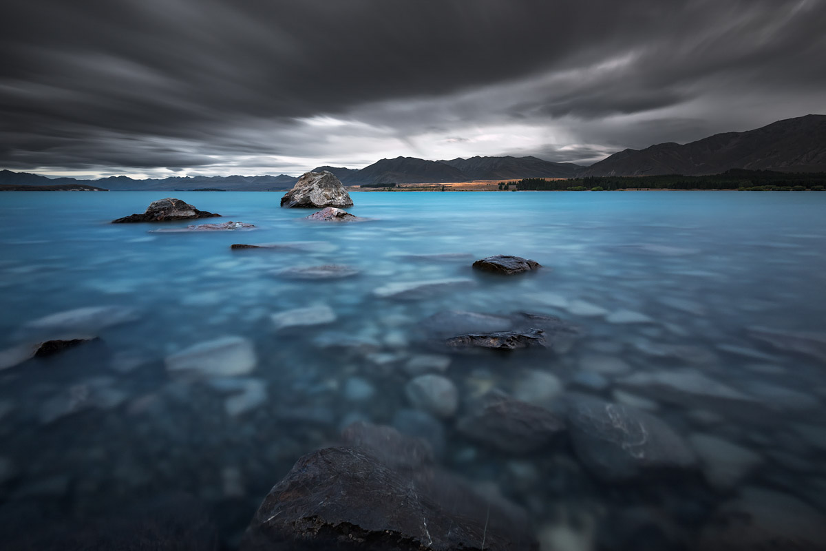
A long exposure on a gloomy evening
Church of the Good Shepherd
For much of its 80 and a bit years, the Church of the Good Shepherd has sat peacefully beside the shore of Lake Tekapo, fulfilling its role as a place of worship and contemplation. However, in recent times, fueled by a tourism boom and its now iconic status through platforms such as Instagram, the church and surrounds has become overrun with a gazillion visitors (approximate count only) hustling and bustling to get their iPad selfies. As a consequence, the Church has recently erected a temporary fence to control the hordes and introduced a permit system for commercial photography; an unfortunate move but the only right one in the circumstances.

Taken a few years ago when you didn’t need to Photoshop out people climbing the walls of the church with their selfie stick

Two icons in one shot: flowering lupins and the Church of the Good Shepherd
Mt John
At 1,029 metres high (but only 320 m above Lake Tekapo), Mt John is a rocky relic from a time when the Mackenzie Basin was covered in ice. Offering commanding 360 degree views of Lake Tekapo, Lake Alexandrina, the Mackenzie Basin, and the Southern Alps, it is a must do when in the area. The summit is also home to the University of Canterbury Mount John Observatory, where night time tours show off the dark southern skies. A cafe is open during the daylight hours.
Mt John can be ascended via a 90 minute walk from the Lake Tekapo township, or if the climb isn’t for you, the summit can be accessed by vehicle via Godley Peaks Road (a gate fee applies).

Sunset from Mt John, viewed towards the headwaters of Lake Tekapo; Motuariki Island can be seen in the lake
Lupins
When it comes to these pretty pests, Lake Tekapo is lupin central. During November and December they’re practically everywhere, including many places they shouldn’t be. Hence the weed classification. I’ve written a lot more about them in my A Brief Guide to Lupins (you’ll also find more shots of Lake Tekapo over there).

Sky and land compete for most colourful (this was taken on the same evening as the stormy foreshore shots above)

When a westerly weather system picks up it can get a tad windy at Lake Tekapo

Loopy lupins (with Mt John in the background)
Above and around
Lake Tekapo is surrounded by a vast area of mountains, rivers, and lakes. Just down the road lies Lakes Pukaki, Ohau and Benmore, and a little beyond that, Aoraki/Mt Cook National Park (check out my A Brief Guide). Here’s a few highlights from some nearby spots.

An aerial view of the Godley River near its source in the Southern Alps; the Godley is the main contributor to Lake Tekapo

Nature’s arteries; where the Godley enters Lake Tekapo

Lake Alexandrina on a pleasant summer evening; being a wildlife refuge no powered craft are allowed on the lake

It doesn’t get more Kiwi than this; baches (holiday homes) line the southern shore of Lake Alexandrina

Braemar Road on a -14 degree Celcius morning
For more information
Visit Tekapo Tourism (includes webcams), Lake Tekapo New Zealand, or Tourism New Zealand.
Awesome Daniel, really informative and beautiful shots
Thanks so much Sandy, glad you enjoyed the read!