A Brief Guide to South Island Roads
It has been said the journey is just as important as the destination. Who exactly said this first isn’t entirely clear: it might’ve been Buddha, it could’ve been Aerosmith, but for all I know it might be one of the several thousand Instagrammers using it as their bio tagline. A mystery for another day.
My point is, what truer expression of the phrase than the roads of the South Island, New Zealand, where almost every kilometre of tar seal sits among a landscape so breath-taking that accidents can and do happen. Whether it’s a trip from Nelson to Takaka, Christchurch to Greymouth, Queenstown to Milford Sound, and all the curvy alignments in between, a journey along a South Island road is every as bit as thrilling as the destination.
As I mention in a little more detail in A Brief Guide to the South Island for Landscape Photographers, traveling around the South Island via the road network is generally straight-forward. The main highways and most local roads are sealed and well maintained, although with our terrain being typically hilly or mountainous the travel times can be a lot longer than the distance might otherwise suggest.
Safe stopping opportunities for photography can be limited so pick your spots wisely. Don’t be one of those people who think it’s entirely appropriate to slam on the brakes and park in the middle of the lane to ‘get the shot’. In a 100 km/h zone. With 87 cars backed up behind you. And if you’re going to get one of those shots of “someone walking wistfully down the centreline of a major highway into the distance pretending it’s not a major highway but rather the standard way we walk from A to B around here” be sure to use a spotter for your own safety.
Without further ado here are some of my favourite roads from around the South Island. All clickable images lead you to a place where you can have the image on your wall! Also check out my road gallery.

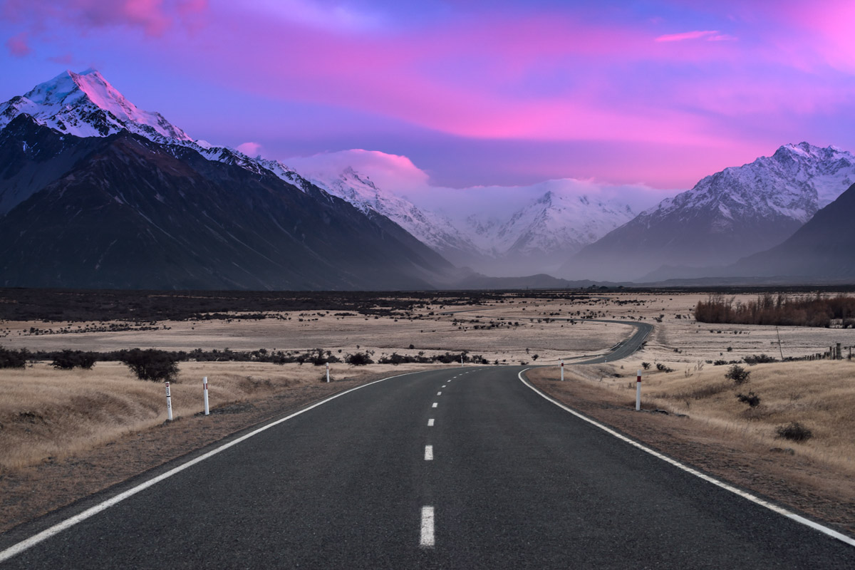
State Highway 80 approaching Aoraki-Mt Cook (3,724 m) has many iconic moments, this one being among my favourite spots

This view from Bennett’s Bluff, obtained around half-way along the 60 minute drive between Queenstown and Glenorchy, looks up Lake Wakatipu towards Mt Earnslaw

Near the end of the road, on the northern West Coast of the South Island
Another iconic moment from State Highway 80, this time looking towards the Tasman Valley (with Aoraki-Mt Cook to the left of frame)

Driving the long and dusty road into Mt Aspiring National Park is quite the adventure

The wintery back roads of the Mackenzie Country, shot on a -14 degree C morning

Iconic moment #3 on State Highway 80: the view from Peter’s Lookout towards Aoraki-Mt Cook

State Highway 6 weaving along the narrow strip between the Tasman Sea and Paparoa National Park on the wild west coast

The road to the Hooker Valley, Aoraki-Mt Cook National Park, with it’s many adventures lying beyond

Road with a view – State Highway 80
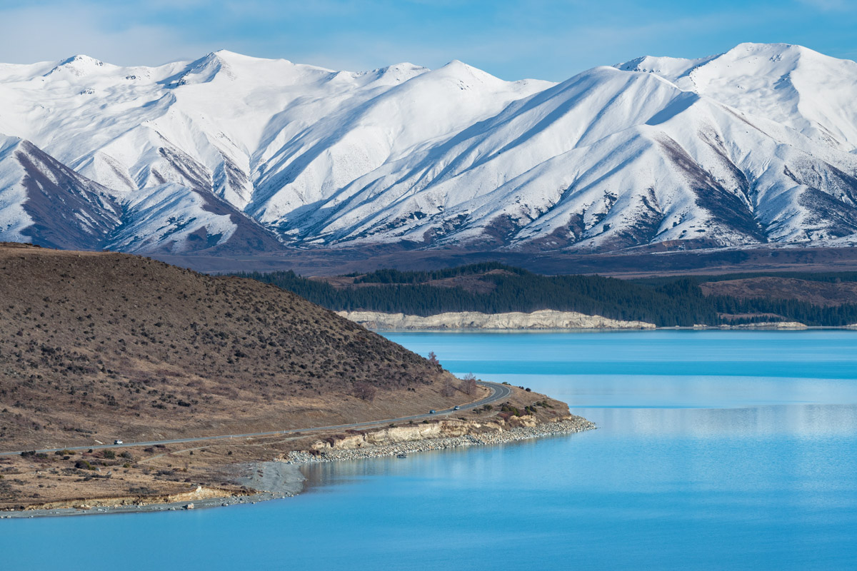
When State Highway 80 comes alongside Lake Pukaki the sight of its glacial blue water is almost too difficult to believe

In early summer the lupin flowers line the canals of the Mackenzie Country and add the icing on the cake to an already incredible scene

The southern approach to Lindis Pass, on State Highway 8 between Omarama and Wanaka

What the hey, here’s a fourth shot of State Highway 80 – it sure delivers the goods!
Great stuff Dan! Thanks a lot!
Hope you’re doing well and have fun on the upcoming workshop.
Cheers,
Tiago Afonso
Thanks heaps mate. All good here – haven’t been out with the camera much recently but hoping to change that soon!