A Brief Guide to Mt Titiroa
A 4-day adventure exploring a surreal Fiordland landscape
Just one full day after completing the Mt Owen tramp, my alarm went off at 5am and shortly after I was on an 8-hour drive south to Lake Manapouri. By 3pm, I was on a dinghy crossing Pearl Harbour (the New Zealand rather than Hawaii version, clearly) and a few minutes after that, had 23 kilograms on my back and was making my way towards the granity slopes of Mt Titiroa (1,715m).
It wasn’t long before I was wondering whether I’d bitten off more than I could chew. My body was still feeling pretty wrecked after Mt Owen, and coupled with all those hours in the car, pain levels were high and energy levels were low. Thankfully, the first 2.5 hours to Hope Arm was on an easy gradient and served as the perfect introduction to get my body back up and running again.
At around 9pm I made it to Garnock Burn. By then, the last few days caught up with me and I was relieved to setup camp, eat some dinner, and collapse into my sleeping bag. Rest was definitely needed, as first thing tomorrow I was heading off track and gaining 1,250m elevation. Ahead of me was some of the most mind-blowing landscapes I’ve yet encountered.
Words don’t really do this place justice; enjoy the video and images.
Video highlights from Mt Titiroa (4K cinematic; 25 minutes long)
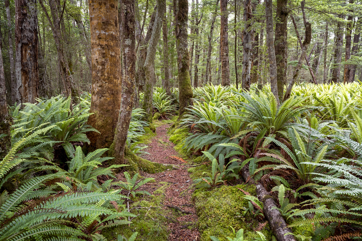
Although beautiful to look at, the forest floor around here isn’t entirely natural: the mono-culture of ferns is due to grazing by introduced deer
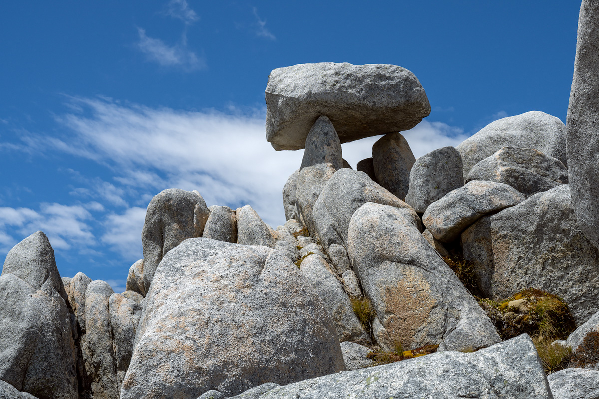
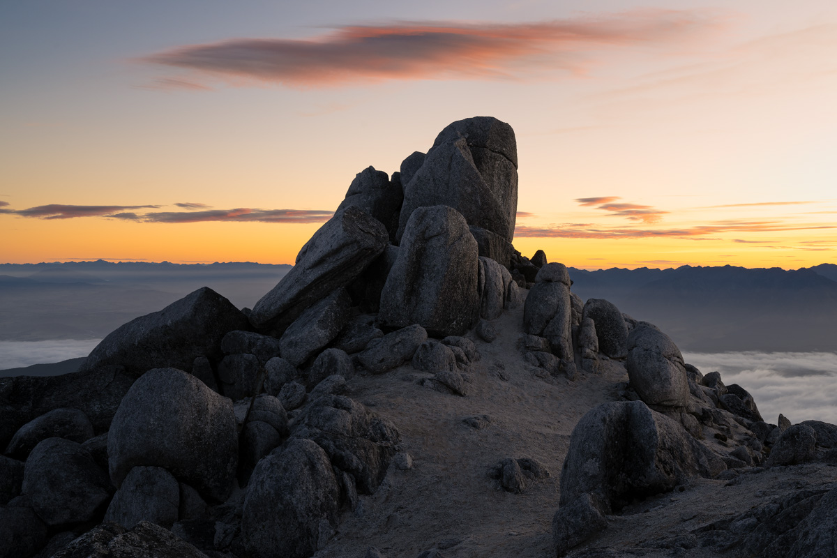
The granite rocks on Titiroa are arranged in all sorts of weird and wonderful ways
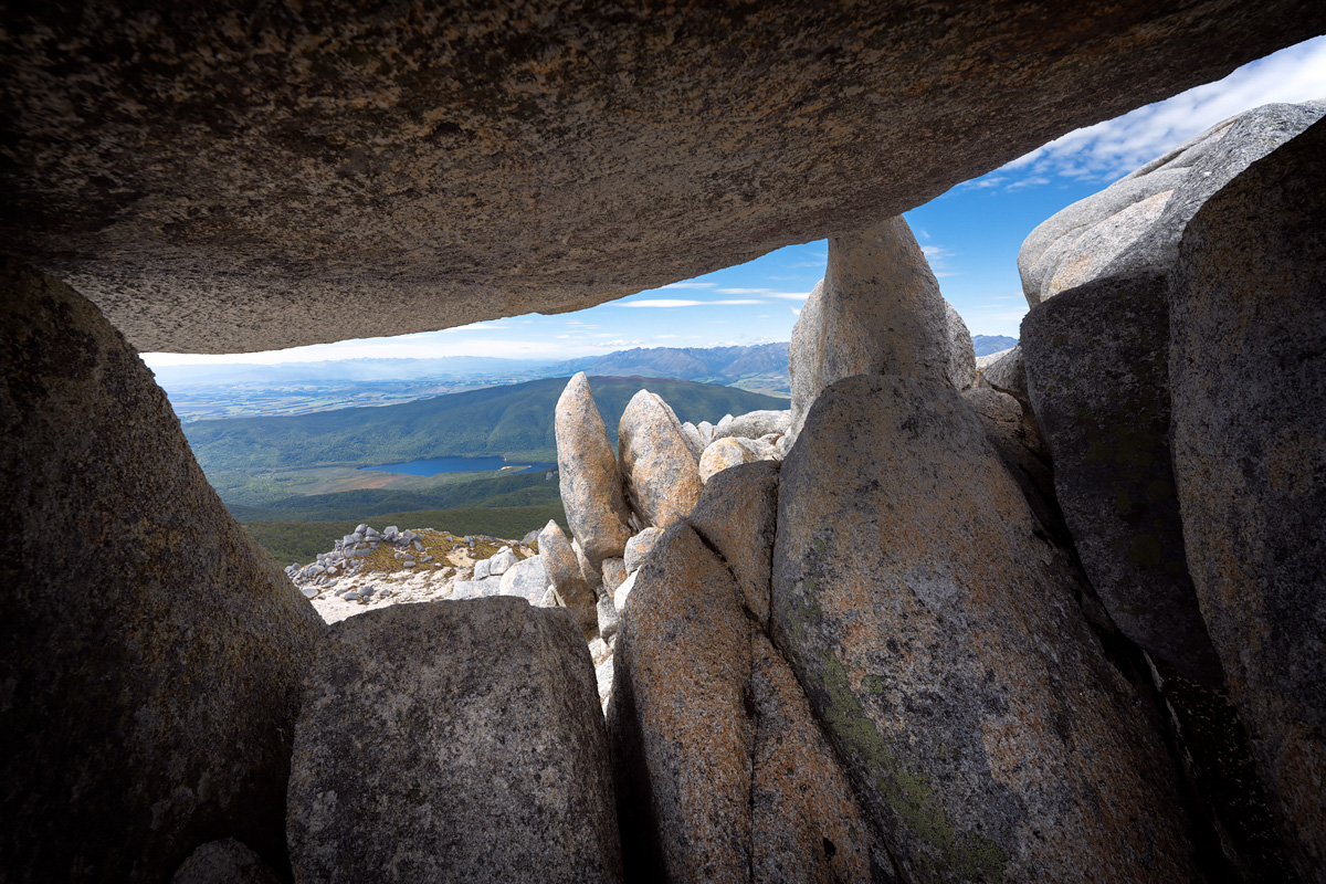
This little alcove served as a perfect spot to escape the midday sun and enjoy a bite to eat
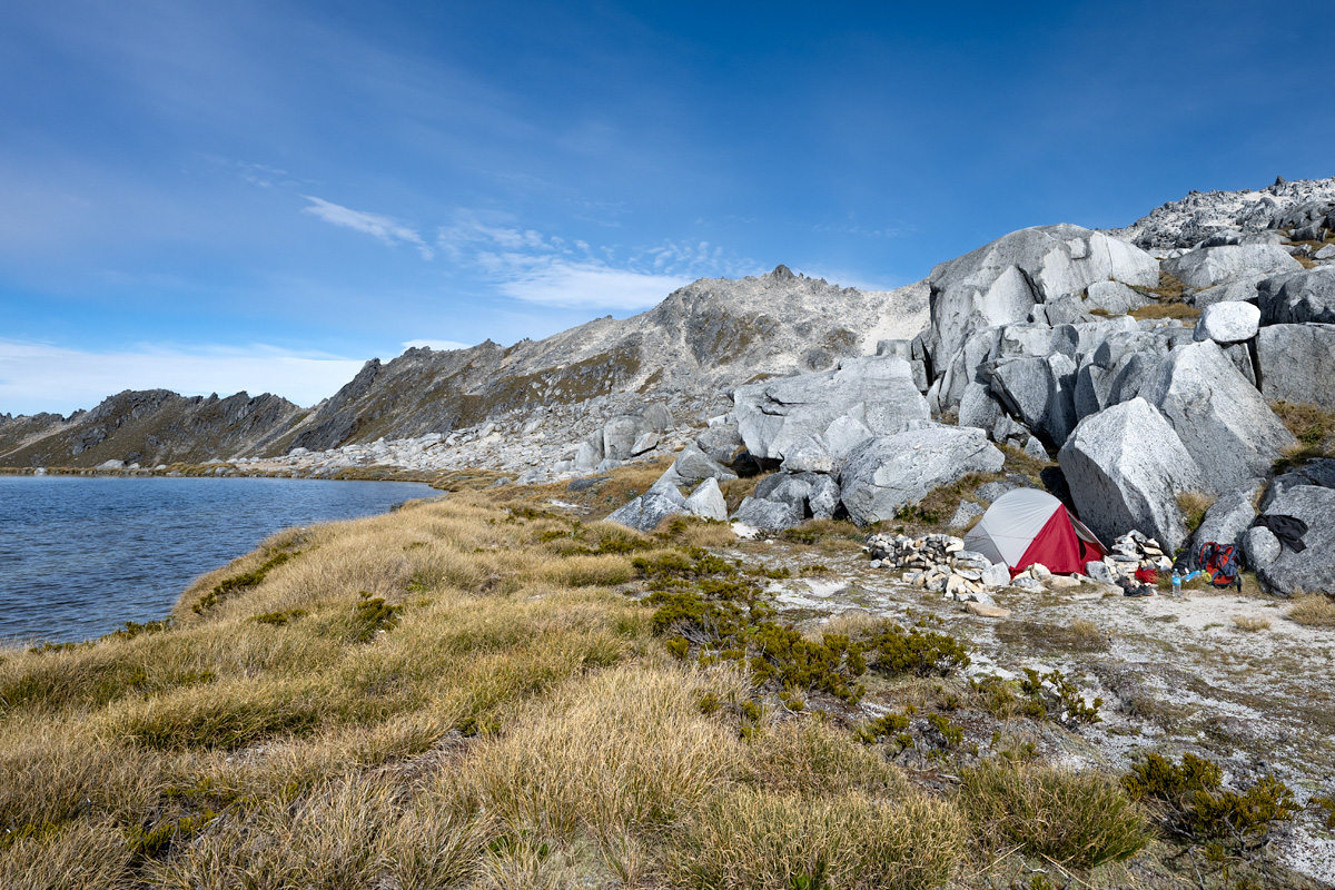
My campsite on night 2: an unnamed tarn around 200 metres elevation below the summit of Titiroa
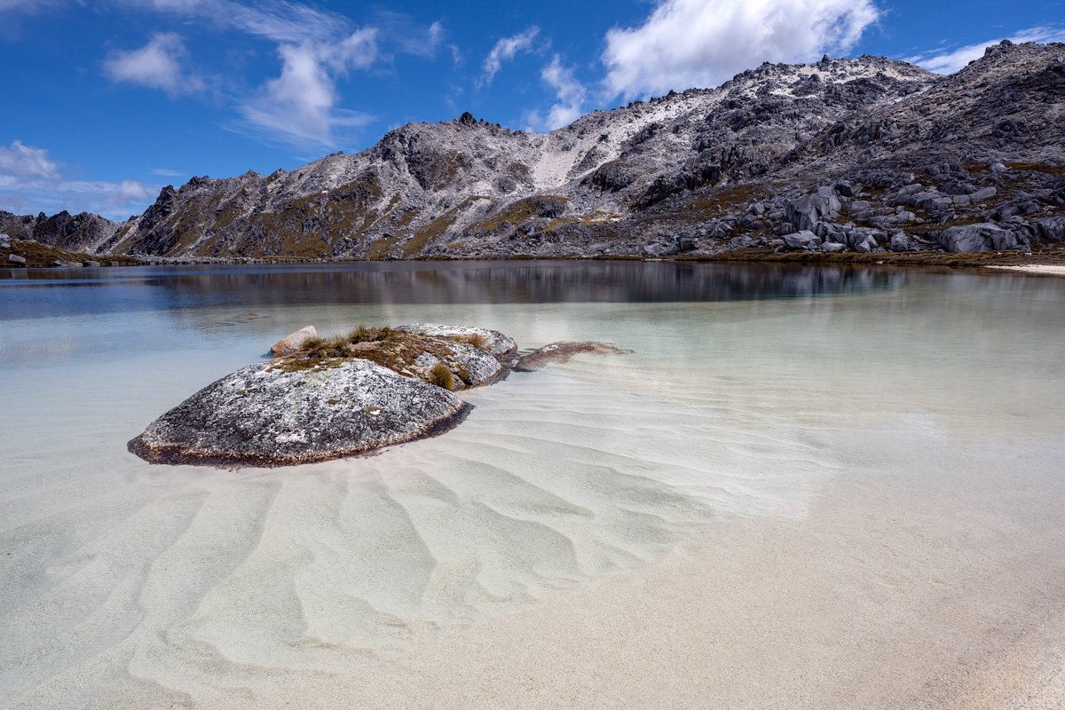
My own private beach (water was a little chilly though!)

View from the top, looking towards Lake Manapouri. Garnock Burn is visible in the valley far below.
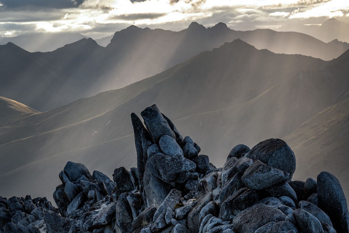
The setting sun slicing through ridgelines generated some great photography conditions
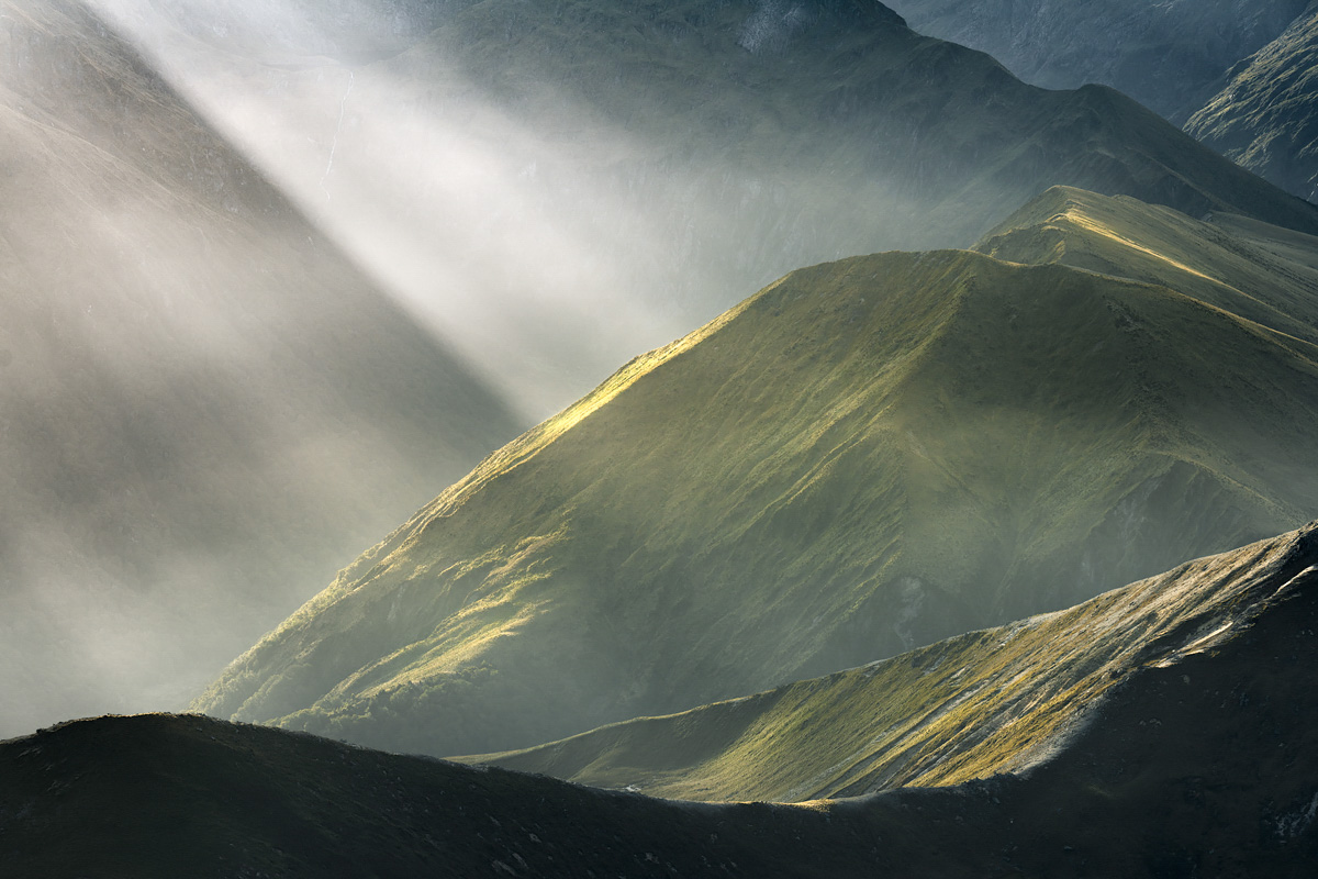
I was in photography heaven!
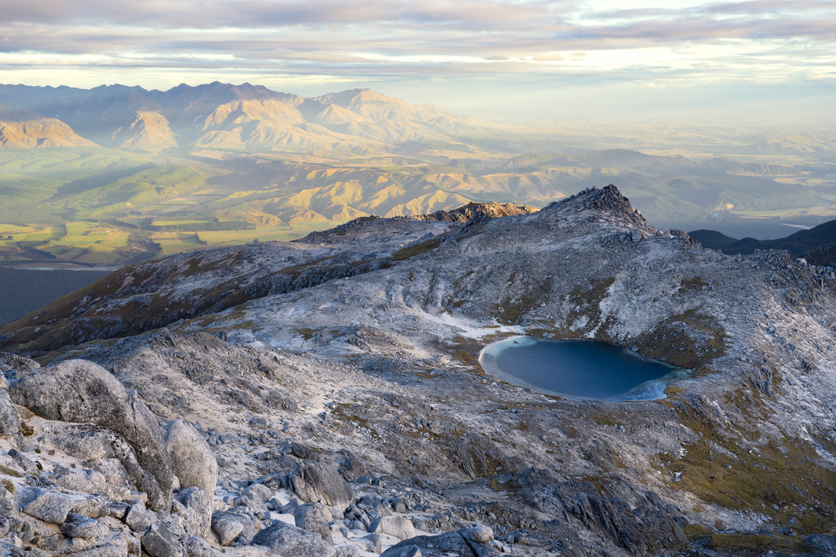
A view from near the Titiroa summit down to my campsite beside the unnamed tarn
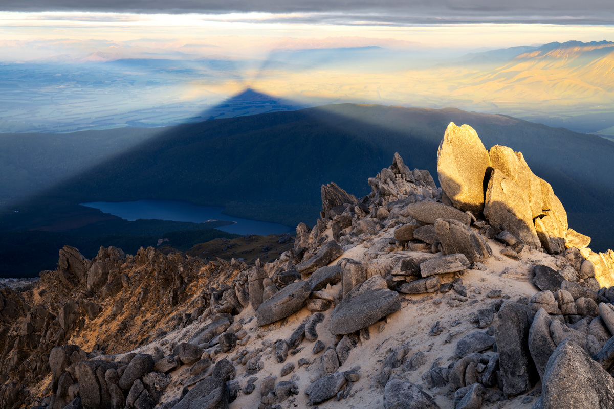
Titiroa’s shadow cast over Lake Rakatu and the Manapouri basin
Titiroa summit (1,715m) at sunrise
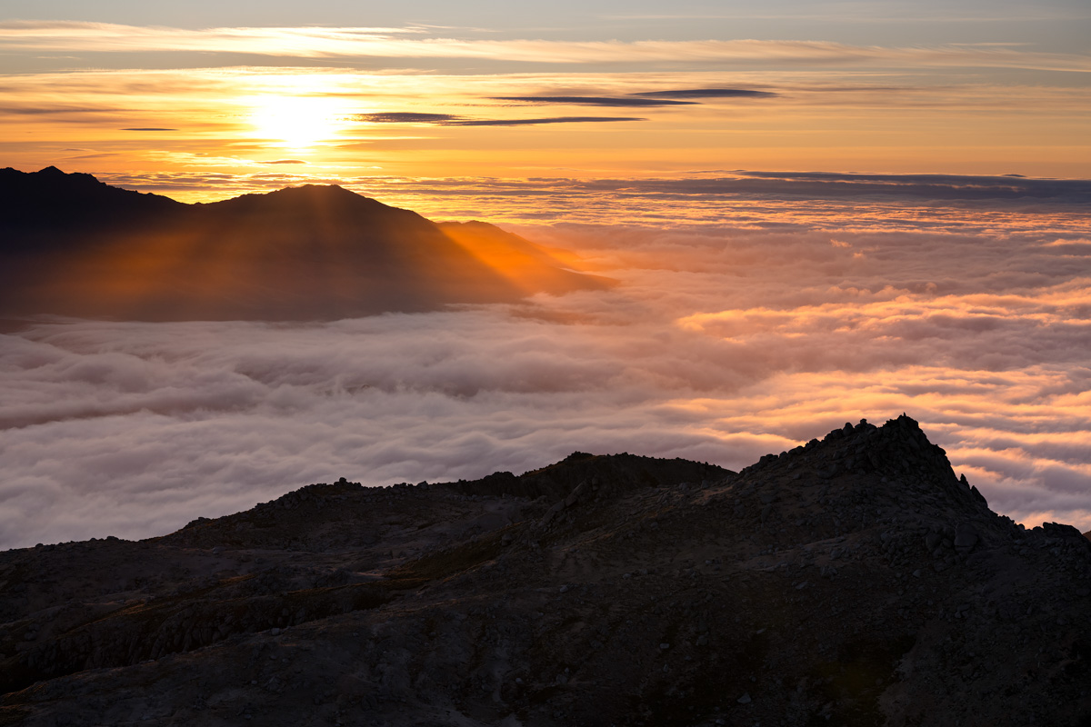
Looking south-east over inversion cloud to the rising sun
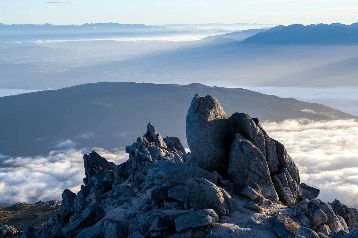
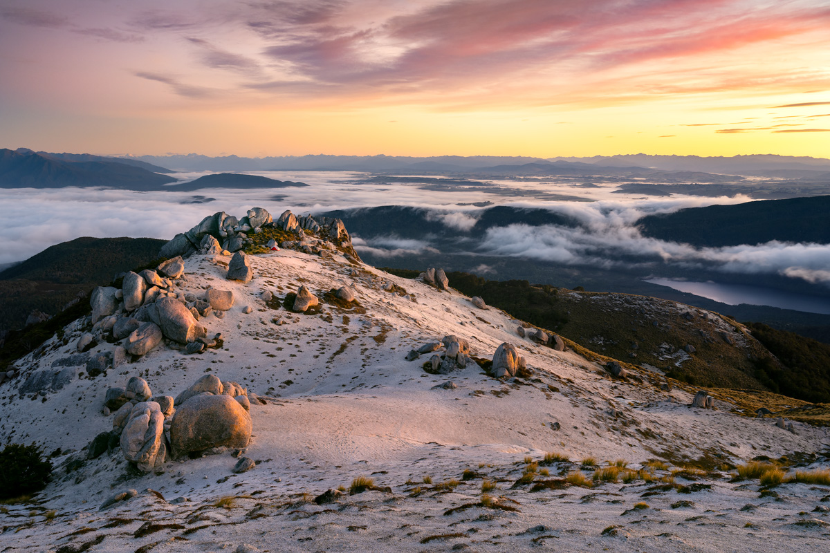
The summit a little later in the morning
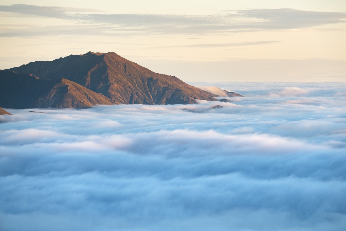
More inversion goodness
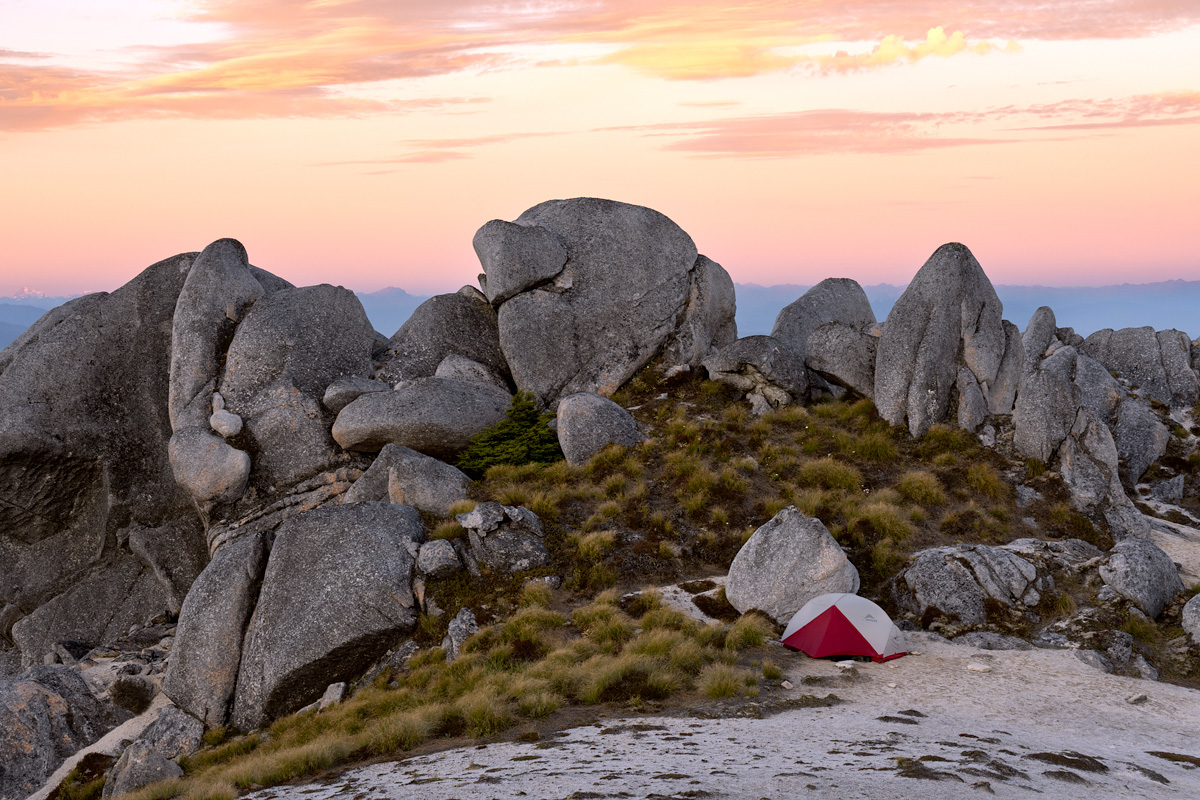
Campsite on night 3 on the north ridge of Titiroa at around point 1125m
Leave A Comment