A Brief Guide to Karamea
Tucked away in the remote north-west corner of the South Island at the end of a no-exit road, Karamea is the quintessential slice of paradise. With relatively few people and vast wildness on its doorstep, the hustle and bustle of the world quickly fades from your memory soon after you arrive.
Due to its isolation the township is relatively small, with a resident population of just 375 people. There’s a 4-Square supermarket, petrol station, a hotel, a small number of accommodation providers and café/restaurants, and a few tourism operators, but there aren’t too many more facilities than that. When I visited the area recently I stayed at the colourful Rongo, which has just completed the transition from a backpackers to bed and breakfast. An amazing garden, a wonderful and eclectic collection of art, and the best dinner in town make Rongo a must-stay!


Approaching the end of the road; the view towards Kohaihai
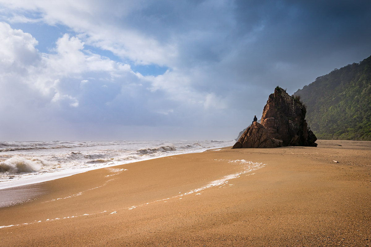
Sitting on the wild shores of the Tasman Sea, Karamea lies beside a large coastal lagoon, and beyond in both directions extends miles of beach with barely a soul in sight. Facing west, the coastline here is an amazing place to take in the setting sun or watch the arrival of one of the frequent westerly storms (Karamea has a sub-tropical micro-climate and receives 2 m of rain per annum).

Those West Coast sunsets

Rain ETA approximately 5 minutes
On all other sides Karamea is surrounded by the vast Kahurangi National Park, New Zealand’s second largest at 450,000 hectares. Ancient beech and podocarp forests, draped with intensely green mosses and ferns, extend from the white coastal sands into the hills as far as the eye can see. Rivers, stained with the organic tannins from decomposing organic matter, provide a unique colour contrast.

A misty morning view across the wild lands of Kahurangi National Park

The colour of the tannin stained rivers vary in intensity and colour depending on the season and rainfall
Karamea is the southern entry point to the famous Heaphy Track. From Kohaihai (home to a Department of Conservation campground), located 16 km north of Karamea, a walk to Scott’s Beach provide a great introduction to the coastal section of the track. Passing through nikau palms and several waterfalls, it often feels like you’re exploring a tropical island.
The Wild West Coast: Scott’s Beach
Inland of Karamea lies the fast-becoming-famous Oparara Basin, a place of giant limestone arches and caves. Formed over the last 35 million years, this place makes you feel like you’ve been transported to a prehistoric age. The basin is located only 20km from Karamea, but it takes longer to get there than you might think. Much of the drive is along an old forestry road, which in places is very narrow and windy. So narrow that in several spots, if you meet a vehicle coming the other way, you’ll play that ‘shall I reverse or shall you reverse’ game with just hand gestures and head movements. However, once you’ve reached the carpark there are great day facilities in the form of toilets and picnic areas, and the tracks in the area are well marked and graded. From the carpark the areas biggest attractions, Moria Gate Arch and Oparara Arch, are around 15 and 25 minute walk (one-way) respectively.

Moria Gate Arch, one of the many features in the area named after locations in The Lord of the Rings

Oparara Arch: at 219 m long and up to 43 m high, it’s the largest natural rock arch in the Southern Hemisphere
For more information on the area be sure to check out Karamea Info.
Disclaimer: While in Karamea I stayed at Rongo courtesy of Rongo and Tourism West Coast.
Beautifull place.Lived there as a teenager married a Karamea guy.Been married 54 years go back every year for 11 weeks whitebaiting.The arch is amazing the walks stunning.Done the Heaphy track in my younger years.Have two sons 4 grandchildren they all love going there to.Managed the Last Resort for 2 years really enjoyed that.Go there frequently when on holiday.A place not to be missed just don’t think there’s enough known about it or advirtising.
Wow Leonie, what wonderful memories those must be. I can definitely understand how you’d form a strong connection to the place – it has that magnetic draw!
Living just across the ditch in Canberra, Karamea is our very favourite destination in NZ. Just don’t let too many folk know it exists.
Thanks Monica, I’ll be sure to keep it on the down-low! 🙂