A Brief Guide to Earnslaw Burn
A hike to a spectacular glacier-formed valley in the shadow of Mt Earnslaw
From the famous vantage point of Bennett’s Bluff on the Queenstown-Glenorchy Road, the heavily glaciated peak of Mt Earnslaw (2,830m) looms large at the head of Lake Wakatipu. Getting closer to the mountain had long been on my wish list; in early January 2021 that dream was finally fulfilled.
After getting some last-minute supplies in Queenstown (including the compulsory pre-tramp meat pie), Lee Cook and I made the 63 km drive towards Paradise, which sits just beyond the township of Glenorchy. Yes, Paradise is a real place name, and yes, it’s suitably appropriate.
The Earnslaw Burn Track starts on the true-left (eastern) side of the Earnslaw Burn near the point at which the river emerges from the forest onto the grassy flats. The access road is identified as “Lovers Leap” on most maps although it didn’t appear to be sign-posted when we visited. Outwardly it just looks like a farm track.

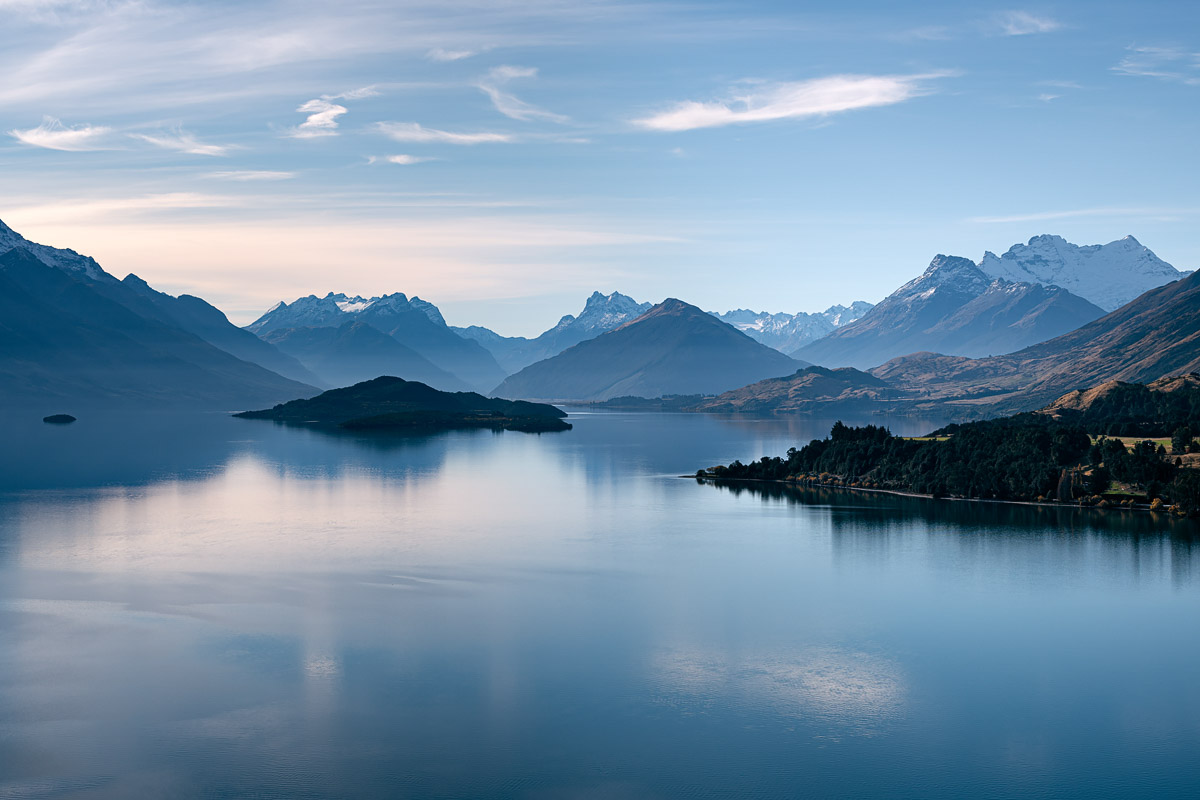
Mt Earnslaw (2,830m) at the far right, as viewed from Bennett’s Bluff
The Department of Conservation describes the walk as an ‘advanced tramping track’. As such it’s not to be taken lightly. It requires backcountry experience, survival skills and equipment, and a good level of fitness. When we went through the track had the appearance of not being maintained for quite some time, with tree fall, ruts and slips being a semi-regular occurrence. At times we found ourselves crawling under trees and using our hands to haul ourselves up/down steep banks. When it rains, as it did on both our walk in and out, the slippery conditions require more concentration and effort. There is no cellphone reception.
All these things are to be expected on advanced tramping tracks. But it’s not a stroll in the park and good preparation is key. I always carry a first aid kit and personal locator beacon on such trips.
The first 3-4 hours are spent enclosed within the forested slopes of the Earnslaw Burn, occasionally crossing small unbridged side streams. The track stays well above the river and it’s only at the bushline they meet again. At this point around 7 km and 500 m elevation gain has been achieved, although with lots of ups and downs it feels like more effort than that!
Beyond the bushline the vista opens up immediately and it’s not long before the Earnslaw Glacier and multiple waterfalls come into view. Although unmarked, the track through this section is much faster than the forest with the only obstacles being some boggy sections, a scramble or two along eroded river banks, and the incredibly spiky Aciphylla colensoi (you’ll know it when you come into contact with one). The gradient also reduces significantly throughout this section.
There are several opportunities for pitching tents above the bushline, save the aforementioned obstacles. We found a primo spot around 60 minutes walk from the bushline and about 5 minutes before the stream which drops from Lennox Pass.
From our campsite it was around 25 minutes walk to the head of the valley. As such it proved to be a good launching pad for exploring the surrounds. There are also some grassy flats near the head of the valley which would be suitable camping spots, although you may have to share your site with the occasional helicopter (Heliworks has exclusive landing access to the valley).

Our home for two nights, located around 25 minutes walk from the head of the valley
The photography opportunities are incredible although I’m not sure I’ve been that successful in giving full justice to the scenery. The scale of the bluffs and icefield, which rise 2 km almost vertically from the valley floor, is truly immense. So much so, that even using my wide-angle lens at 16mm it was difficult to capture peak to foreground in a single shot (I sometimes used vertical panoramas to overcome this). During our visit we also found the light to be a bit challenging due to the enclosed nature of the valley and very strong contrasts.
A note about the valley’s many waterfalls. Looking at other people’s images and videos there are several permanent waterfalls but many are ephemeral. Even the permanent ones can reduce to a trickle at times. To see them at their best I imagine you’d either need to time a trip during or immediately following rainfall, or otherwise a hot period in mid summer when ice-melt is at its peak. I suspect in the winter, when most precipitation is falling as snow, is the least best time to see them in action.
Here’s a few highlights!

The head of the Earnslaw Burn; for scale those cliffs are approximately 1,000m high, then it’s a further 1,000m vertical to the summit of Mt Earnslaw

The waterfall on the left is perhaps the most iconic in the valley; it featured in ‘The Hobbit: An Unexpected Journey’ (the dwarves walked under it soon after leaving Rivendell)

There’s a fair few of these gnarly small trees around the place; this one was split down the middle and made for an interesting composition

Pre-dawn reflections on one of the several small tarns dotting the valley floor

A 1.6 second exposure gives this waterfall a smooth and surreal quality

This waterfall cascades down right beside the track around 40 minutes from the head of the valley

Leave A Comment