A Brief Guide to Lake Angelus
3 days on an advanced tramping track in Nelson Lakes National Park
Tucked away in the northern part of the South Island, Nelson Lakes National Park isn’t as well known or visited as some of its northern and southern cousins. But when it comes to classic New Zealand landscapes and stunning scenery, the park ticks all the boxes and then some.
St Arnaud, on the northern shores of Lake Rotoiti, is the gateway to the area. With a resident population of only 120 people, facilities are fairly limited. However, being a tourism/holiday destination most of the basics are present including several accommodation providers, a handful of restaurants/cafes, a petrol station, and a convenience store. If you’re planning spending a lot of time in the area it’d be advantageous to stock up on key supplies before arriving in the area. Nelson is the nearest major centre at 88 km / 1 hr 20 mins drive away.

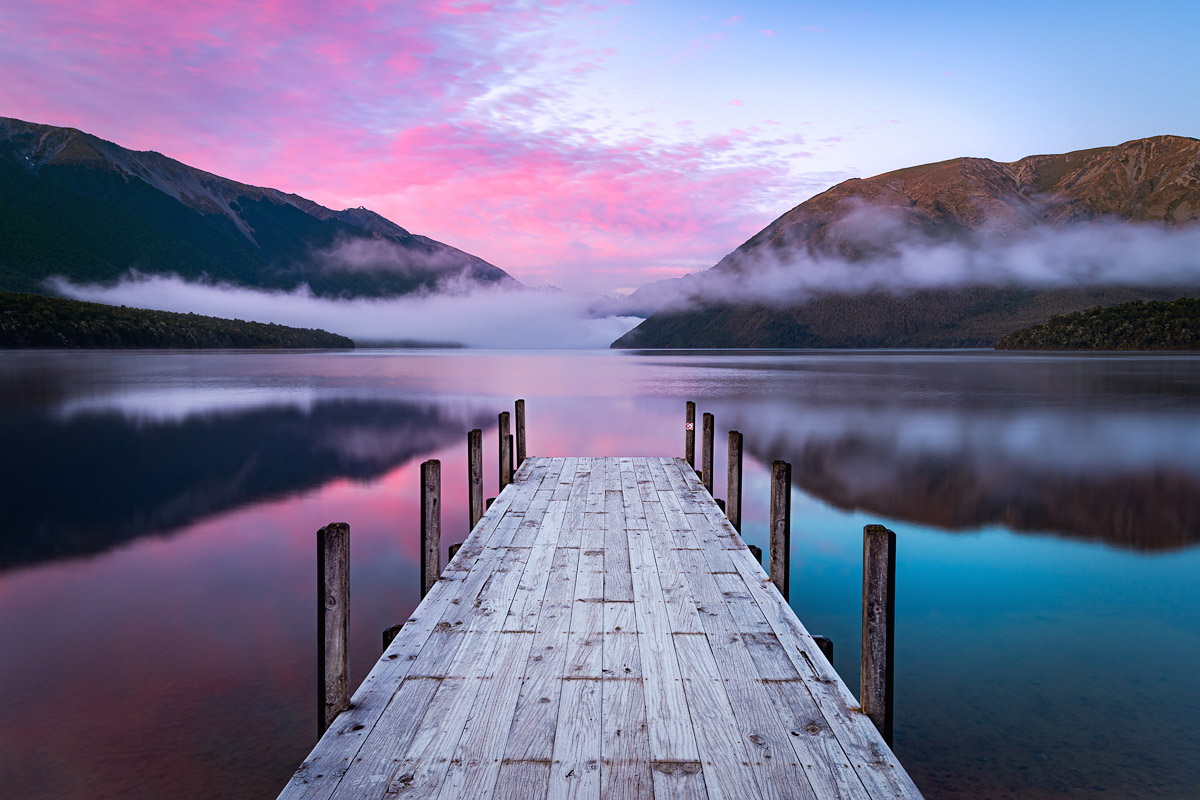
Lake Rotoiti, St Arnaud. The first part of the Robert Ridge Route into Lake Angelus climbs Mt Robert on the right of this image.
The walk into Lake Angelus (Rotomaninitua) is one of the most popular walks in the park. There are several ways of getting there, however, with a minimum distance and time of 12 km and 5-6 hours respectively to reach the lake there isn’t an option falling into the day-walk category. Thankfully the 28-bunk Angelus Hut provides overnight accommodation and tenting spots are also available near the hut. Fees apply year round and bookings are essential between 30 November and 1 April and on public holiday weekends.
Facilities at the hut are basic. There are mattresses, water supply (boiling may be necessary), toilets, hand washing facilities and heating with fuel available. Everything else will need to be carried in on your back. During peak season a warden will likely be present to confirm your booking.
The Department of Conservation website contains a full description of all routes into Angelus Hut.
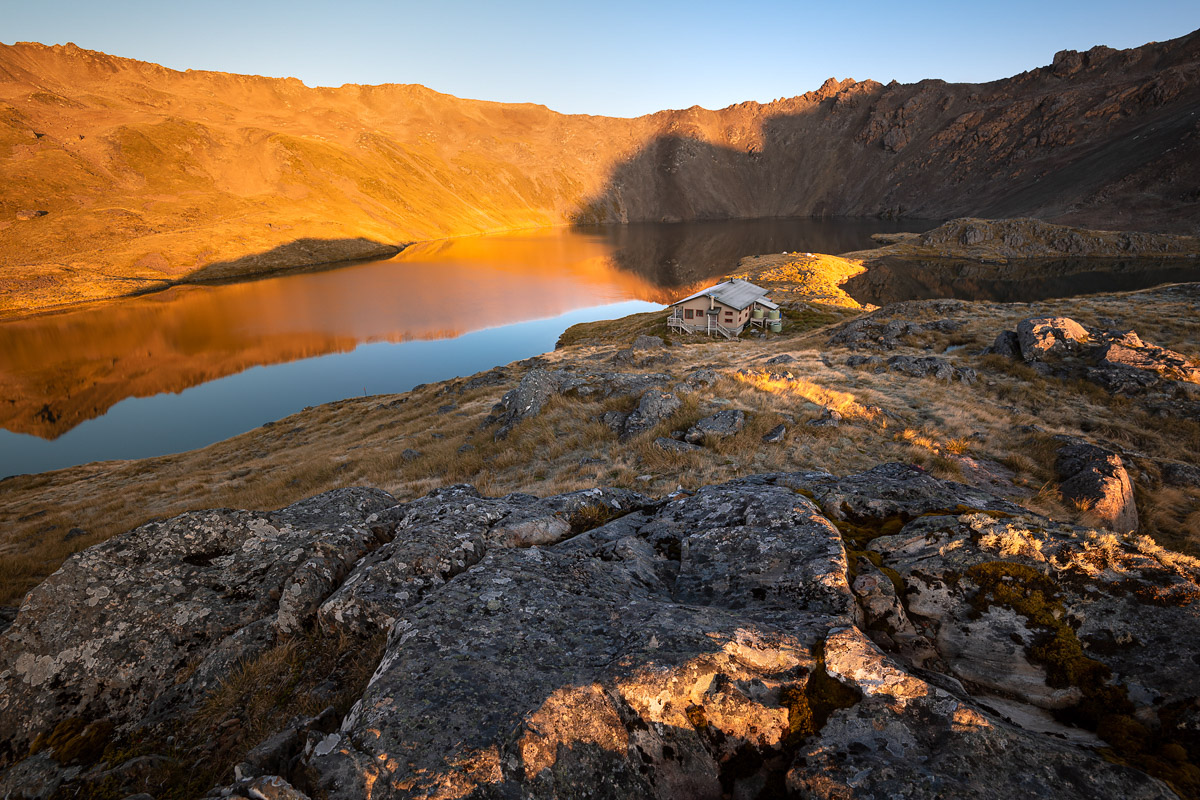
Lake Angelus / Rotomaninitua and Angelus Hut

Lake Angelus at dawn; Angelus Peak (2,075m) fills the centre of the frame
At an altitude of 1,65o m, the lake is high enough that even in the middle of summer the area can experience snow, frosts and bone-chilling winds. In winter, the lake will freeze and the hut has been known to disappear completely under snow. Needless to say this destination, and the walk to get there, is for experienced and well-equipped hikers only. I’ve included some further safety notes at the end of this article, which includes a link to a great video explaining the various routes and things you’ll need to be prepared for.
On this adventure we walked into the hut via the Robert Ridge Route (6 hours), spent our second day exploring the Lake Angelus area (including a 4-hour return walk to Sunset Saddle), and on the third day walked out via the Speargrass Creek route (6 hours). This 5-minute video contains all the highlights!
A highlights reel of my 3 days on the trip, including route details and some photographs
The most popular route into Lake Angelus is via the Robert Ridge; the “track” is visible here through one of the trickiest sections

Jack Burden (website) taking in the expansive views from near Sunset Saddle; Lake Angelus and Hinapouri Tarn are visible on the right

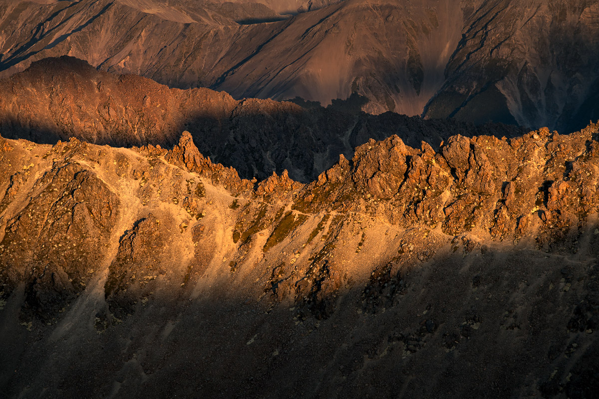
The otherworldly landscape of the Angelus Basin
On the photography front, the landscapes are superlative and among the most beautiful I’ve ever seen. Never-ending mountain ranges with craggy tops, countless crystal-clear alpine tarns, tumbling streams, forested valleys: the beauty is overwhelming. And what I’ve seen is just a tiny slice of the national park in a tiny window of time and weather conditions.
Below are some more images capturing during my time in the area. There are several more sitting in my library which await processing and I hope to publish at a later date.
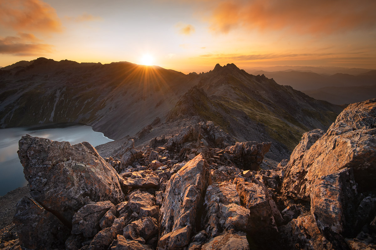
Sunset viewed from peak 1805 above Lake Angelus

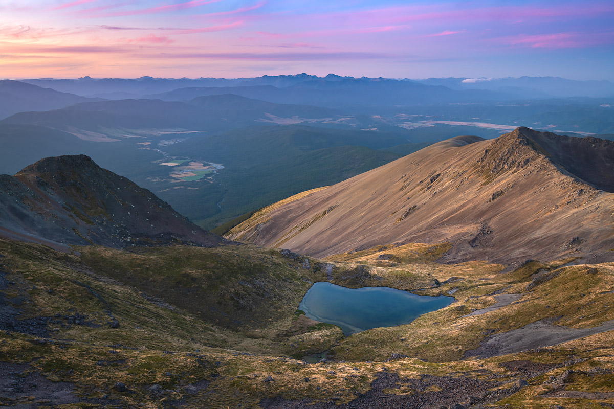
The expansive ranges of Kahurangi National Park

Taken from the same spot as the previous image, just a little bit later in the evening

Lake Rotorua viewed from a point near Sunset Saddle
A post-sunset view down the Hinemoata valley towards Kahurangi National Park

A long exposure (25 seconds) of inversion cloud in the Hukere Stream valley, taken at sunrise
A final but important note about safety…
A trip into Lake Angelus is not for the inexperienced, unfit, or those with a fear of heights or rock scrambling.
In DOC’s 6-tier track system all routes into Lake Angelus are classified as “Advanced: tramping track”, just one tier below the most challenging routes of all. DOC describes such tracks as being suitable for “people with moderate to high level backcountry (remote areas) skills and experience, navigation and survival skills required“.
This video from the NZ Mountain Safety Council provides a great overview of the main routes into Lake Angelus, with a particular focus on the Robert Ridge Route. It includes information on essential equipment and the type of weather and conditions that can be encountered.
Have you been to Lake Angelus or explored other parts of Nelson Lakes National Park?
I’d love to hear your experiences in the comments below!
Leave A Comment